Druid Hills
- För Druid Hills i Kentucky, se Druid Hills, Kentucky.
| Druid Hills | |
| CDP | |
| Delstat | Georgia |
|---|---|
| Indelning | DeKalb County |
| Koordinater | 33°47′14″N 84°19′33″V / 33.78722°N 84.32583°V / 33.78722; -84.32583 |
| Yta | 10,9 km² (2010)[1] |
| - land | 10,8 km² |
| - vatten | 0,1 km² |
| Folkmängd | 14 568 (2010)[2] |
| Befolkningstäthet | 1 349 invånare/km² |
| Tidszon | Eastern (UTC-5) |
| - sommartid | Eastern (UTC-4) |
| Postnummer | 30030, 30033, 30306–30307, 30322, 30329[3] |
| FIPS | 1324264 |
| Geonames | 4192088 |
  Ortens läge i Georgia | |
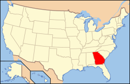 Georgias läge i USA | |
Druid Hills är en förort till Atlanta, belägen i DeKalb County i Georgia. Platsen hade 12 741 invånare vid folkräkningen 2000. Emory University och Centers for Disease Control and Prevention ligger i Druid Hills.
Källor
- ^ ”2010 Census Gazetteer Files”. US Census Bureau. Arkiverad från originalet den 14 juli 2012. https://www.webcitation.org/699nOulzi?url=http://www.census.gov/geo/www/gazetteer/files/Gaz_places_national.txt. Läst 14 juli 2012.
- ^ ”Druid Hills CDP, Georgia” (på engelska). State & County Quickfacts. U.S. Census Bureau,. Arkiverad från originalet den 21 juli 2012. https://www.webcitation.org/69KPnvSHI?url=http://quickfacts.census.gov/qfd/states/13/1324264.html. Läst 21 juli 2012.
- ^ ”2010 ZIP Code Tabulation Area (ZCTA) Relationship Files”. U.S. Census Bureau. 3 juli 2010. Arkiverad från originalet den 25 augusti 2012. https://www.webcitation.org/6ABdwXxbq?url=http://www.census.gov/geo/www/2010census/zcta_rel/zcta_place_rel_10.txt. Läst 25 augusti 2012.


