Gnadenwald

Cet article est une ébauche concernant une localité autrichienne.
Vous pouvez partager vos connaissances en l’améliorant (comment ?) selon les recommandations des projets correspondants.
| Gnadenwald | ||||
 Héraldique | ||||
 | ||||
| Administration | ||||
|---|---|---|---|---|
| Pays |  Autriche Autriche | |||
| Land |  Tyrol Tyrol | |||
| District (Bezirk) | Innsbruck-Land | |||
| Maire | Heidi Profeta | |||
| Code postal | A-6069 | |||
| Immatriculation | IL | |||
| Indicatif | +43(0)5223 | |||
| Code Commune | 7 03 11 | |||
| Démographie | ||||
| Population | 787 hab. () | |||
| Densité | 69 hab./km2 | |||
| Géographie | ||||
| Coordonnées | 47° 19′ 00″ nord, 11° 33′ 00″ est | |||
| Altitude | 879 m | |||
| Superficie | 1 148 ha = 11,48 km2 | |||
| Localisation | ||||
| Géolocalisation sur la carte : Autriche
Géolocalisation sur la carte : Autriche
Géolocalisation sur la carte : Tyrol
| ||||
| Liens | ||||
| Site web | www.gnadenwald.tirol.gv.at | |||
modifier  | ||||


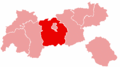
Gnadenwald est une commune autrichienne du district d'Innsbruck-Land dans le Tyrol.
Géographie

Cette section est vide, insuffisamment détaillée ou incomplète. Votre aide est la bienvenue ! Comment faire ?
Histoire
Cette section est vide, insuffisamment détaillée ou incomplète. Votre aide est la bienvenue ! Comment faire ?
Jumelage

Liens externes
- (fr) Site web touristique de Gnadenwald (région Hall-Wattens)
 Portail de l'Autriche


