Comté de Yellowhead

Cet article est une ébauche concernant l’Alberta.
Vous pouvez partager vos connaissances en l’améliorant (comment ?) selon les recommandations des projets correspondants.
| Comté de Yellowhead | ||
| Administration | ||
|---|---|---|
| Pays |  Canada Canada | |
| Province |  Alberta Alberta | |
| Région | Alberta central | |
| Statut municipal | district municipal | |
| Maire | Gerald Soroka | |
| Constitution | 1994 | |
| Démographie | ||
| Population | 10 469 hab. (2011) | |
| Densité | 0,47 hab./km2 | |
| Géographie | ||
| Coordonnées | 53° 34′ 54″ nord, 116° 26′ 04″ ouest | |
| Superficie | 2 229 626 ha = 22 296,26 km2 | |
| Divers | ||
| Fuseau horaire | UTC-7 | |
| Code géographique | 4814003 | |
| Localisation | ||
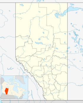
| Géolocalisation sur la carte : Alberta
| ||
| Liens | ||
| Site web | www.yellowheadcounty.ab.ca | |
modifier  | ||

Le comté de Yellowhead (anglais : Yellowhead County) est un district municipal situé dans la province d'Alberta, au Canada.
Communautés et localités
- Edson
- Hinton
- Autres
- Tollerton
- Hameaux
- Brûlé
- Cadomin
- Evansburg
- MacKay
- Marlboro
- Niton Junction
- Peers
- Pinedale
- Pine Shadows
- Robb
- Wildwood
- Localités[1]
- Ansell
- Balkan
- Basing
- Bickerdike
- Branch Inn Trailer Court
- Brule Mines
- Brûlé Mines
- Bryan
- Calvert
- Carrot Creek
- Chip Lake
- Coal Valley
- Coalspur
- Dalehurst
- Diss
- Drinnan
- Embarras
- Entrance
- Erith
- Erith Tie
- Fidler
- Foothills
- Galloway
- Granada
- Grave Flats
- Gregg Subdivision
- Haddock
- Hanlon
- Hansonville
- Hargwen
- Hattonford
- Hoff
- Holloway
- Hornbeck
- Kaydee
- Leaman
- Leyland
- Lobstick
- Lovettville
- Luscar
- Mahaska
- Matthews Crossing
- McLeod River
- McLeod Valley
- Medicine Lodge
- Mercoal
- Mountain Park
- Mountain View Estates
- Niton
- Nojack ou No Jack
- Northville
- Obed
- Oke
- Old Entrance
- Park Court
- Pedley
- Pembina Forks
- Pine Dale Subdivision
- Pine Shadows
- Pinedale Estates
- Pioneer
- Rangeton
- Ravine
- Reco
- Rosevear
- Shaw
- Shining Bank
- Solomon
- Steeper
- Sterco
- Styal
- Swan Landing
- Trade Winds Trailer Court
- Two Rivers Estates
- Weald
- Wild Hay
- Wolf Creek
- Yates


Démographie
| 2001 | 2006 | 2011 | 2016 |
|---|---|---|---|
| 9 881 | 10 045 | 10 469 | 10 995 |
Sources : Statistiques Canada 2006[2] Statistiques Canada 2016[3]

Références
- (en) Cet article est partiellement ou en totalité issu de l’article de Wikipédia en anglais intitulé « Yellowhead County, Alberta » (voir la liste des auteurs).
- ↑ « Yellowhead County, codes géographiques et localités, 2006 », sur Statistique Canada (consulté le ).
- ↑ « Statistique Canada - Profils des communautés de 2006 - Yellowhead County, MD » (consulté le )
- ↑ « Statistique Canada - Profils des communautés de 2016 - Yellowhead County, MD » (consulté le )
Annexes
Sur les autres projets Wikimedia :
- Comté de Yellowhead, sur Wikimedia Commons
Articles connexes
Liens externes
- Site officiel
v · m | ||
|---|---|---|
| Subdivisions |
|  |
| Communautés |
| |
| Cités et secteurs de services urbains |
| |
| Régions | ||
Subdivisions de :
| ||
 Portail de l’Alberta


