Uhingen
German city
Town in Baden-Württemberg, Germany

Coat of arms
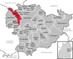
Location of Uhingen within Göppingen district
48°42′21″N 9°35′31″E / 48.70583°N 9.59194°E / 48.70583; 9.59194
(2022-12-31)[1]
73062–73066
Uhingen is a town in the district of Göppingen in Baden-Württemberg in southern Germany.
History
Uhingen was a possession of the County of Aichelberg [de] until 1332.[2]
Geography
The city (Stadt) of Uhingen is located on the north-west of the district of Göppingen, in the German state of Baden-Württemberg. The municipal area lies along the border with the Rems-Murr district to the north. Physically, Uhingen is situated in the lower Fils river valley, in the foothills of the Central Swabia Jura [de]. A portion of the municipal area is in the Schurwald region, to the northwest. Elevation above sea level in the municipal area ranges from a low of 257 meters (843 ft) Normalnull (NN) to a high of 483 meters (1,585 ft) NN.[2]
The Federally-protected Bärentobel [de] nature reserve is located in Uhingen's municipal area.[2]
Politics
Uhingen has six more boroughs (Stadtteile): Baiereck, Holzhausen, Sparwiesen, Nassach, Diegelsberg and Nassachmühle.[2]
Coat of arms
Uhingen's coat of arms displays a field of red crossed by a white, wavy fess complemented with a white canton in the upper left corner of the blazon. This pattern, devised by the Central State Archive Stuttgart [de] in 1912, is the coat of arms of the House of Aichelberg, with the addition of the fess to represent the river Fils.[2]
Transportation
Uhingen is a center of local transportation and an infrastructure nexus. The city is connected to Germany's network of roadways by Bundesstraße 10 and Bundesstraße 297 [de]. It is also connected to Germany's railways by the Fils Valley Railway, which was run through the municipal area in 1847. Public transportation is provided by Deutsche Bahn , the VVS and the Uhingen Citizens' Bus Association.[2]
References
- ^ "Bevölkerung nach Nationalität und Geschlecht am 31. Dezember 2022" [Population by nationality and sex as of December 31, 2022] (CSV) (in German). Statistisches Landesamt Baden-Württemberg. June 2023.
- ^ a b c d e f "Uhingen". LEO-BW (in German). Baden-Württemberg. Retrieved 26 July 2020.
External links
Wikimedia Commons has media related to Uhingen.
- Official website
 (in German)
- v
- t
- e
Towns and municipalities in Göppingen (district)
- Adelberg
- Aichelberg
- Albershausen
- Bad Boll
- Bad Ditzenbach
- Bad Überkingen
- Birenbach
- Böhmenkirch
- Börtlingen
- Deggingen
- Donzdorf
- Drackenstein
- Dürnau
- Ebersbach an der Fils
- Eislingen
- Eschenbach
- Gammelshausen
- Geislingen an der Steige
- Gingen an der Fils
- Göppingen
- Gruibingen
- Hattenhofen
- Heiningen
- Hohenstadt
- Kuchen
- Lauterstein
- Mühlhausen im Täle
- Ottenbach
- Rechberghausen
- Salach
- Schlat
- Schlierbach
- Süßen
- Uhingen
- Wäschenbeuren
- Wangen
- Wiesensteig
- Zell unter Aichelberg

Authority control databases | |
|---|---|
| International |
|
| National |
|
| Geographic |
|


