Sunray, Oklahoma
Census designated place in Oklahoma, United States
34°24′40″N 97°57′37″W / 34.41111°N 97.96028°W / 34.41111; -97.96028 (2020)
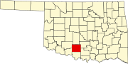
Sunray (also Beckett) is a small unincorporated community in Stephens County, Oklahoma, United States. It is south of Duncan on U.S. Route 81.
The community is adjacent to the old DX-Sunray refinery (TOSCO Corp. Duncan refinery) which closed in 1983 and was imploded in 2006.[citation needed]
Demographics
| Census | Pop. | Note | %± |
|---|---|---|---|
| 2020 | 853 | — | |
| U.S. Decennial Census[3] | |||
Climate
Climate is characterized by relatively high temperatures and evenly distributed precipitation throughout the year. The Köppen Climate Classification subtype for this climate is "Cfa" (Humid Subtropical Climate).[4]
References
- ^ "ArcGIS REST Services Directory". United States Census Bureau. Retrieved September 20, 2022.
- ^ a b U.S. Geological Survey Geographic Names Information System: Sunray, Oklahoma
- ^ "Census of Population and Housing". Census.gov. Retrieved June 4, 2016.
- ^ "Sunray, Oklahoma Köppen Climate Classification (Weatherbase)". Weatherbase.
- v
- t
- e
Municipalities and communities of Stephens County, Oklahoma, United States
County seat: Duncan
- Sunray
communities
‡This populated place also has portions in an adjacent county or counties
- Oklahoma portal
- United States portal
 | This Oklahoma state location article is a stub. You can help Wikipedia by expanding it. |
- v
- t
- e


