Spokane, Louisiana
Census-designated place in Louisiana, United States
31°41′58″N 91°27′37″W / 31.69944°N 91.46028°W / 31.69944; -91.46028 United States
 Louisiana
 (2020)
71334
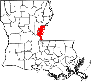
Spokane is an unincorporated community and census-designated place (CDP) in Concordia Parish, Louisiana, United States. As of the 2010 census it had a population of 442.[2]
It is located in northeastern Concordia Parish on the southwest side of Lake St. John, an oxbow lake that is a former channel of the Mississippi River. Louisiana State Highway 568 leads southwest from Spokane 7 miles (11 km) to Ferriday.
Demographics
| Census | Pop. | Note | %± |
|---|---|---|---|
| 2020 | 378 | — | |
| U.S. Decennial Census[3] | |||
References
- ^ "2020 U.S. Gazetteer Files". United States Census Bureau. Retrieved March 20, 2022.
- ^ "Geographic Identifiers: 2010 Demographic Profile Data (G001): Spokane CDP, Louisiana". U.S. Census Bureau, American Factfinder. Archived from the original on February 12, 2020. Retrieved August 21, 2014.
- ^ "Census of Population and Housing". Census.gov. Retrieved June 4, 2016.
- v
- t
- e
Municipalities and communities of Concordia Parish, Louisiana, United States
Parish seat: Vidalia
communities
- Acme
- Ashland
- Blackhawk
- Eva
- Fairview
- Frogmore
- New Era
- Shaw
- Wildsville
- West Ferriday
- Louisiana portal
- United States portal
 | This Louisiana state location article is a stub. You can help Wikipedia by expanding it. |
- v
- t
- e


