Santander de Quilichao
City in Cauca Department, Colombia

Flag

Seal
City of the Samanes
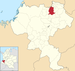
Location of the city Santander de Quilichao.
 Colombia
 (2023)[1]
Santander de Quilichao is a city in the north of the Cauca Department, Colombia at 97 km to the north of Popayán and 45 km to the south of Cali.
Climate
| Climate data for Santander de Quilichao (Japio), elevation 1,015 m (3,330 ft), (1981–2010) | |||||||||||||
|---|---|---|---|---|---|---|---|---|---|---|---|---|---|
| Month | Jan | Feb | Mar | Apr | May | Jun | Jul | Aug | Sep | Oct | Nov | Dec | Year |
| Mean daily maximum °C (°F) | 29.0 (84.2) | 29.2 (84.6) | 29.3 (84.7) | 28.9 (84.0) | 28.6 (83.5) | 28.8 (83.8) | 29.4 (84.9) | 30.2 (86.4) | 29.5 (85.1) | 28.7 (83.7) | 28.2 (82.8) | 28.5 (83.3) | 29.0 (84.2) |
| Daily mean °C (°F) | 23.5 (74.3) | 23.7 (74.7) | 23.6 (74.5) | 23.5 (74.3) | 23.4 (74.1) | 23.5 (74.3) | 23.6 (74.5) | 24.1 (75.4) | 23.8 (74.8) | 23.3 (73.9) | 23.1 (73.6) | 23.4 (74.1) | 23.6 (74.5) |
| Mean daily minimum °C (°F) | 18.5 (65.3) | 18.5 (65.3) | 18.7 (65.7) | 18.8 (65.8) | 18.7 (65.7) | 18.3 (64.9) | 17.5 (63.5) | 17.5 (63.5) | 18.0 (64.4) | 18.4 (65.1) | 18.6 (65.5) | 18.7 (65.7) | 18.3 (64.9) |
| Average precipitation mm (inches) | 147.7 (5.81) | 141.2 (5.56) | 180.7 (7.11) | 224.4 (8.83) | 159.8 (6.29) | 93.3 (3.67) | 51.1 (2.01) | 67.4 (2.65) | 113.0 (4.45) | 212.0 (8.35) | 228.4 (8.99) | 167.1 (6.58) | 1,786.2 (70.32) |
| Average precipitation days | 12 | 11 | 14 | 16 | 13 | 10 | 7 | 6 | 11 | 16 | 16 | 13 | 145 |
| Average relative humidity (%) | 78 | 78 | 78 | 80 | 80 | 79 | 75 | 72 | 75 | 79 | 80 | 79 | 78 |
| Source: Instituto de Hidrologia Meteorologia y Estudios Ambientales[2] | |||||||||||||
References
External links
- (in Spanish) Santander de Quilichao official website
- v
- t
- e
Municipalities in the Cauca Department
- Almaguer
- Argelia
- Balboa
- Bolívar
- Buenos Aires
- Cajibio
- Caldono
- Caloto
- Corinto
- El Tambo
- Florencia
- Guachené
- Guapi
- Inzá
- Jambaló
- La Sierra
- La Vega
- López de Micay
- Mercaderes
- Miranda
- Morales
- Padilla
- Páez
- Patía
- Piamonte
- Piendamó
- Popayán
- Puerto Tejada
- Puracé
- Rosas
- San Sebastián
- Santander de Quilichao
- Santa Rosa
- Silvia
- Sotara
- Suárez
- Sucre
- Timbío
- Timbiquí
- Toribío
- Totoró
- Villa Rica

3°01′N 76°29′W / 3.017°N 76.483°W / 3.017; -76.483
Authority control databases | |
|---|---|
| International |
|
| National |
|
 | This Department of Cauca location article is a stub. You can help Wikipedia by expanding it. |
- v
- t
- e


