Michinmahuida
Mountain in Chile


Michinmahuida
Chile
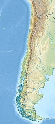
Michinmahuida (Spanish pronunciation: [mitʃinmaˈwiða]) (alternate spellings Minchinmávida or Michimahuida) is a glaciated stratovolcano located in Los Lagos Region of Chile. It lies about 15 km east of Chaitén volcano, and was extensively covered in ash during the 2008 eruption of Chaitén.[2] The stratovolcano lies above the regional Liquine-Ofqui Fault zone, and the ice-covered massif towers over the south portion of Pumalín Park. It has a summit elevation of 2,450 meters above sea level.
See also
- List of volcanoes in Chile
- Chaitén
- Chaitén (volcano)
- List of Ultras of South America
References
- ^ a b c "Argentina and Chile, Southern: Patagonia Ultra-Prominences" Peaklist.org. Retrieved 2012-04-16.
- ^ "Minchinmavida and Chaiten Volcanoes, Chile". 9 March 2009.
Sources
- "Michinmahuida". Global Volcanism Program. Smithsonian Institution.
- "Volcán Minchinmavida, Chile" on Peakbagger
- "South American Summits Ranked by Re-ascent"
- v
- t
- e
Andean volcanoes
(6° N – 3° S)
- Paipa-Iza
- Romeral
- Cerro Bravo
- Nevado del Ruiz
- Nevado del Tolima
- Nevado del Huila
- Puracé
- Doña Juana
- Galeras
- Azufral
- Chiles
- Cayambe
- Reventador
- Pichincha
- Antisana
- Aliso
- Soche
- Illiniza
- Cotopaxi
- Quilotoa
- Chimborazo
- Tungurahua
- Licto volcanic field
- Sangay
(14°–27° S)
- Quimsachata
- Auquihuato
- Firura
- Sara Sara
- Solimana
- Coropuna
- Hualca Hualca
- Sabancaya
- Huambo volcanic field
- Ampato
- Andagua volcanic field
- Chachani
- Misti
- Ubinas
- Pichu Pichu
- Huaynaputina
- Ticsani
- Tutupaca
- Yucamane
- Purupuruni
- Casiri
- Tacora
- Taapaca
- Parinacota
- Lauca
- Guallatiri
- Tata Sabaya
- Isluga
- Irruputuncu
- Olca-Paruma
- Aucanquilcha
- Azufre
- Zapaleri
- Sairecabur
- Licancabur
- Purico complex
- Pacana
- Aguas Calientes
- Lascar
- Chiliques
- Aracar
- Socompa
- Llullaillaco
- Lastarria
- Lazufre
- Cordón del Azufre
- Galán
- Peinado
- San Francisco
- Cueros de Purulla
- Incahuasi
- Ojos del Salado
(33°–46° S)
- Tupungato
- Tupungatito
- Maipo
- Calabozos
- Descabezado Grande
- Cerro Azul
- Nevado de Longaví
- Nevados de Chillán
- Antuco
- Copahue
- Callaqui
- Lonquimay
- Llaima
- Sollipulli
- Villarrica
- Quetrupillán
- Lanín
- Mocho-Choshuenco
- Carrán-Los Venados
- Puyehue-Cordón Caulle
- Casablanca
- Osorno
- Calbuco
- Hornopirén
- Huequi
- Michinmahuida
- Chaitén
- Corcovado
- Mentolat
- Cay
- Macá
- Mate Grande
- Hudson
(49°–55° S)
Note: volcanoes are ordered by latitude from north to south
 | This Los Lagos Region location article is a stub. You can help Wikipedia by expanding it. |
- v
- t
- e
 | This article related to a mountain, mountain range, or peak in Chile is a stub. You can help Wikipedia by expanding it. |
- v
- t
- e


