Fenton Lake State Park
Park in New Mexico, USA
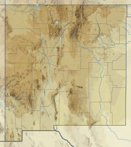
35°52′57″N 106°43′35″W / 35.88250°N 106.72639°W / 35.88250; -106.72639
Fenton Lake State Park is a state park of New Mexico, USA, located 33 miles (53 km) north of San Ysidro, in the Jemez Mountains.[2] The 37-acre (15 ha) lake is a popular fishing destination.
It was featured as a filming location (showing the splash-landing of an alien spacecraft) in the 1976 movie The Man Who Fell to Earth.[3]
Climate
| Climate data for Chama, New Mexico (1991–2020 normals, extremes 1893–present) | |||||||||||||
|---|---|---|---|---|---|---|---|---|---|---|---|---|---|
| Month | Jan | Feb | Mar | Apr | May | Jun | Jul | Aug | Sep | Oct | Nov | Dec | Year |
| Record high °F (°C) | 63 (17) | 62 (17) | 75 (24) | 78 (26) | 86 (30) | 93 (34) | 99 (37) | 96 (36) | 91 (33) | 80 (27) | 74 (23) | 68 (20) | 99 (37) |
| Mean maximum °F (°C) | 52 (11) | 54 (12) | 60 (16) | 68 (20) | 76 (24) | 85 (29) | 86 (30) | 83 (28) | 80 (27) | 71 (22) | 62 (17) | 55 (13) | 87 (31) |
| Mean daily maximum °F (°C) | 37.1 (2.8) | 39.7 (4.3) | 45.9 (7.7) | 54.2 (12.3) | 63.7 (17.6) | 72.9 (22.7) | 75.6 (24.2) | 72.8 (22.7) | 67.1 (19.5) | 57.1 (13.9) | 44.0 (6.7) | 37.3 (2.9) | 55.6 (13.1) |
| Daily mean °F (°C) | 22.7 (−5.2) | 25.4 (−3.7) | 31.5 (−0.3) | 38.8 (3.8) | 46.4 (8.0) | 54.4 (12.4) | 58.9 (14.9) | 57.5 (14.2) | 51.2 (10.7) | 41.5 (5.3) | 30.9 (−0.6) | 23.2 (−4.9) | 40.2 (4.6) |
| Mean daily minimum °F (°C) | 8.1 (−13.3) | 11.6 (−11.3) | 17.6 (−8.0) | 23.2 (−4.9) | 29.6 (−1.3) | 35.9 (2.2) | 42.3 (5.7) | 42.0 (5.6) | 35.1 (1.7) | 26.1 (−3.3) | 16.5 (−8.6) | 9.7 (−12.4) | 24.8 (−4.0) |
| Mean minimum °F (°C) | −15 (−26) | −12 (−24) | −4 (−20) | 9 (−13) | 18 (−8) | 26 (−3) | 34 (1) | 33 (1) | 24 (−4) | 13 (−11) | −3 (−19) | −12 (−24) | −18 (−28) |
| Record low °F (°C) | −38 (−39) | −37 (−38) | −26 (−32) | −12 (−24) | 5 (−15) | 17 (−8) | 18 (−8) | 22 (−6) | 11 (−12) | −2 (−19) | −29 (−34) | −34 (−37) | −38 (−39) |
| Average precipitation inches (mm) | 1.96 (50) | 1.84 (47) | 1.91 (49) | 1.45 (37) | 1.20 (30) | 1.34 (34) | 3.35 (85) | 3.66 (93) | 2.27 (58) | 1.83 (46) | 1.67 (42) | 1.97 (50) | 24.45 (621) |
| Average snowfall inches (cm) | 22.7 (58) | 22.5 (57) | 22.3 (57) | 11.6 (29) | 3.1 (7.9) | 0.1 (0.25) | 0.0 (0.0) | 0.0 (0.0) | 0.1 (0.25) | 4.1 (10) | 12.3 (31) | 21.3 (54) | 120.1 (304.4) |
| Average extreme snow depth inches (cm) | 10 (25) | 11 (28) | 7 (18) | 2 (5.1) | 0 (0) | 0 (0) | 0 (0) | 0 (0) | 0 (0) | 0 (0) | 1 (2.5) | 5 (13) | 4 (10) |
| Source: https://wrcc.dri.edu/cgi-bin/cliMAIN.pl?nm9820 | |||||||||||||
| Fenton Lake | |
|---|---|
  Fenton Lake | |
| Location | Fenton Lake State Park, New Mexico |
| Coordinates | 35°53′00″N 106°43′26″W / 35.88333°N 106.72389°W / 35.88333; -106.72389 (Fenton Lake) |
| Basin countries | United States |
| Surface area | 37 acres (15 ha) |
References
External links
- Fenton Lake State Park
- v
- t
- e
 Protected areas of New Mexico
- Camino Real de Tierra Adentro
- Old Spanish Trail
- Santa Fe Trail
- Aldo Leopold
- Apache Kid
- Bandelier
- Bisti/De-Na-Zin
- Blue Range
- Bosque del Apache
- Capitan Mountains
- Carlsbad Caverns
- Cebolla
- Chama River Canyon
- Columbine–Hondo
- Cruces Basin
- Dome
- Gila
- Latir Peak
- Manzano Mountain
- Ojito
- Pecos
- Sabinoso
- Salt Creek
- San Pedro Parks
- Sandia Mountain
- West Malpais
- Wheeler Peak
- White Mountain
- Withington
- East Fork Jemez River
- Pecos River
- Red River
- Rio Chama
- Rio Grande
- Bluewater Lake
- Bottomless Lakes
- Brantley Lake
- Caballo Lake
- Cerrillos Hills
- Cimarron Canyon
- City of Rocks
- Clayton Lake
- Conchas Lake
- Coyote Creek
- Eagle Nest Lake
- El Vado Lake
- Elephant Butte Lake
- Fenton Lake
- Heron Lake
- Hyde Memorial
- Leasburg Dam
- Living Desert Zoo and Gardens
- Manzano Mountains
- Mesilla Valley Bosque
- Morphy Lake
- Navajo Lake
- Oasis
- Oliver Lee Memorial
- Pancho Villa
- Percha Dam
- Rio Grande Nature Center
- Rockhound
- Santa Rosa Lake
- Storrie Lake
- Sugarite Canyon
- Sumner Lake
- Ute Lake
- Villanueva


