Creyssac
You can help expand this article with text translated from the corresponding article in French. (August 2012) Click [show] for important translation instructions.
- View a machine-translated version of the French article.
- Machine translation, like DeepL or Google Translate, is a useful starting point for translations, but translators must revise errors as necessary and confirm that the translation is accurate, rather than simply copy-pasting machine-translated text into the English Wikipedia.
- Do not translate text that appears unreliable or low-quality. If possible, verify the text with references provided in the foreign-language article.
- You must provide copyright attribution in the edit summary accompanying your translation by providing an interlanguage link to the source of your translation. A model attribution edit summary is
Content in this edit is translated from the existing French Wikipedia article at [[:fr:Creyssac]]; see its history for attribution. - You may also add the template
{{Translated|fr|Creyssac}}to the talk page. - For more guidance, see Wikipedia:Translation.
Commune in Nouvelle-Aquitaine, France
Creyssac | ||
|---|---|---|
Commune | ||
 A general view of Creyssac | ||
Location of Creyssac  | ||
(2020–2026) Michel Desmoulin[1] | | |
| Area 1 | 4.56 km2 (1.76 sq mi) | |
| Population (2021)[2] | 101 | |
| • Density | 22/km2 (57/sq mi) | |
| Time zone | UTC+01:00 (CET) | |
| • Summer (DST) | UTC+02:00 (CEST) | |
| INSEE/Postal code | 24144 /24350 | |
| Elevation | 82–153 m (269–502 ft) (avg. 100 m or 330 ft) | |
| 1 French Land Register data, which excludes lakes, ponds, glaciers > 1 km2 (0.386 sq mi or 247 acres) and river estuaries. | ||
Creyssac (French pronunciation: [kʁesak]; Occitan: Creissac) is a commune in the Dordogne department in Nouvelle-Aquitaine in southwestern France.
Population
| Year | Pop. | ±% p.a. |
|---|---|---|
| 1968 | 95 | — |
| 1975 | 94 | −0.15% |
| 1982 | 83 | −1.76% |
| 1990 | 81 | −0.30% |
| 1999 | 99 | +2.25% |
| 2009 | 98 | −0.10% |
| 2014 | 91 | −1.47% |
| 2020 | 98 | +1.24% |
| Source: INSEE[3] | ||
Gallery
-
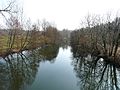
 Gué de l'Éperon
 -
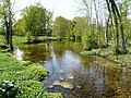
 d'Ambon Pond
 -
 Le Boulou
 -
 L'Euche
 -
 Le Bullidour
 -
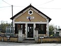 Town Hall
 -
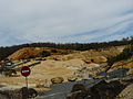 Calcium carbonate mine in Chauffour et Puy Pelan
 -
 Saint-Barthélemy church


See also
References
- ^ "Répertoire national des élus: les maires". data.gouv.fr, Plateforme ouverte des données publiques françaises (in French). 2 December 2020.
- ^ "Populations légales 2021" (in French). The National Institute of Statistics and Economic Studies. 28 December 2023.
- ^ Population en historique depuis 1968, INSEE
Wikimedia Commons has media related to Creyssac.
- v
- t
- e
Communes of the Dordogne department 

- Abjat-sur-Bandiat
- Agonac
- Ajat
- Allas-les-Mines
- Allemans
- Alles-sur-Dordogne
- Angoisse
- Anlhiac
- Annesse-et-Beaulieu
- Antonne-et-Trigonant
- Archignac
- Aubas
- Audrix
- Augignac
- Auriac-du-Périgord
- Azerat
- La Bachellerie
- Badefols-d'Ans
- Badefols-sur-Dordogne
- Baneuil
- Bardou
- Bars
- Bassillac et Auberoche
- Bayac
- Beaumontois-en-Périgord
- Beaupouyet
- Beauregard-de-Terrasson
- Beauregard-et-Bassac
- Beauronne
- Beleymas
- Berbiguières
- Bergeracsubpr
- Bertric-Burée
- Besse
- Beynac-et-Cazenac
- Biras
- Biron
- Boisse
- Boisseuilh
- Bonneville-et-Saint-Avit-de-Fumadières
- Borrèze
- Bosset
- Bouillac
- Boulazac Isle Manoire
- Bouniagues
- Bourdeilles
- Le Bourdeix
- Bourg-des-Maisons
- Bourg-du-Bost
- Bourgnac
- Bourniquel
- Bourrou
- Bouteilles-Saint-Sébastien
- Bouzic
- Brantôme en Périgord
- Brouchaud
- Le Bugue
- Le Buisson-de-Cadouin
- Bussac
- Busserolles
- Bussière-Badil
- Calès
- Calviac-en-Périgord
- Campagnac-lès-Quercy
- Campagne
- Campsegret
- Capdrot
- Carlux
- Carsac-Aillac
- Carsac-de-Gurson
- Carves
- La Cassagne
- Castelnaud-la-Chapelle
- Castels et Bézenac
- Cause-de-Clérans
- Celles
- Cénac-et-Saint-Julien
- Chalagnac
- Chalais
- Champagnac-de-Belair
- Champagne-et-Fontaine
- Champcevinel
- Champniers-et-Reilhac
- Champs-Romain
- Chancelade
- Chantérac
- Chapdeuil
- La Chapelle-Aubareil
- La Chapelle-Faucher
- La Chapelle-Gonaguet
- La Chapelle-Grésignac
- La Chapelle-Montabourlet
- La Chapelle-Montmoreau
- La Chapelle-Saint-Jean
- Chassaignes
- Château-l'Évêque
- Châtres
- Cherval
- Cherveix-Cubas
- Chourgnac
- Cladech
- Clermont-de-Beauregard
- Clermont-d'Excideuil
- Colombier
- Coly-Saint-Amand
- Comberanche-et-Épeluche
- Condat-sur-Trincou
- Condat-sur-Vézère
- Conne-de-Labarde
- Connezac
- La Coquille
- Corgnac-sur-l'Isle
- Cornille
- Les Coteaux Périgourdins
- Coubjours
- Coulaures
- Coulounieix-Chamiers
- Coursac
- Cours-de-Pile
- Coutures
- Coux-et-Bigaroque-Mouzens
- Couze-et-Saint-Front
- Creyssac
- Creysse
- Creyssensac-et-Pissot
- Cubjac-Auvézère-Val d'Ans
- Cunèges
- Daglan
- Doissat
- Domme
- La Dornac
- Douchapt
- Douville
- La Douze
- Douzillac
- Dussac
- Échourgnac
- Église-Neuve-de-Vergt
- Église-Neuve-d'Issac
- Escoire
- Étouars
- Excideuil
- Eygurande-et-Gardedeuil
- Eymet
- Eyraud-Crempse-Maurens
- Eyzerac
- Les Eyzies
- Fanlac
- Les Farges
- Faurilles
- Faux
- La Feuillade
- Firbeix
- Le Fleix
- Fleurac
- Florimont-Gaumier
- Fonroque
- La Force
- Fossemagne
- Fougueyrolles
- Fouleix
- Fraisse
- Gabillou
- Gageac-et-Rouillac
- Gardonne
- Gaugeac
- Génis
- Ginestet
- Gout-Rossignol
- Grand-Brassac
- Granges-d'Ans
- Grignols
- Grives
- Groléjac
- Grun-Bordas
- Hautefaye
- Hautefort
- Issac
- Issigeac
- Jaure
- Javerlhac-et-la-Chapelle-Saint-Robert
- Jayac
- La Jemaye-Ponteyraud
- Journiac
- Jumilhac-le-Grand
- Lacropte
- Lalinde
- Lamonzie-Montastruc
- Lamonzie-Saint-Martin
- Lamothe-Montravel
- Lanouaille
- Lanquais
- Le Lardin-Saint-Lazare
- Larzac
- Lavalade
- Lavaur
- Les Lèches
- Léguillac-de-l'Auche
- Lembras
- Lempzours
- Limeuil
- Limeyrat
- Liorac-sur-Louyre
- Lisle
- Lolme
- Loubejac
- Lunas
- Lusignac
- Lussas-et-Nontronneau
- Manzac-sur-Vern
- Marcillac-Saint-Quentin
- Mareuil en Périgord
- Marnac
- Marquay
- Marsac-sur-l'Isle
- Marsalès
- Mauzac-et-Grand-Castang
- Mauzens-et-Miremont
- Mayac
- Mazeyrolles
- Ménesplet
- Mensignac
- Mescoules
- Meyrals
- Mialet
- Milhac-de-Nontron
- Minzac
- Molières
- Monbazillac
- Monestier
- Monfaucon
- Monmadalès
- Monmarvès
- Monpazier
- Monplaisant
- Monsac
- Monsaguel
- Montagnac-d'Auberoche
- Montagnac-la-Crempse
- Montagrier
- Montaut
- Montazeau
- Montcaret
- Montferrand-du-Périgord
- Montignac-Lascaux
- Montpeyroux
- Montpon-Ménestérol
- Montrem
- Mouleydier
- Moulin-Neuf
- Mussidan
- Nabirat
- Nadaillac
- Nailhac
- Nanteuil-Auriac-de-Bourzac
- Nantheuil
- Nanthiat
- Nastringues
- Naussannes
- Négrondes
- Neuvic
- Nontronsubpr
- Orliac
- Parcoul-Chenaud
- Paulin
- Paunat
- Paussac-et-Saint-Vivien
- Pays-de-Belvès
- Payzac
- Pazayac
- Pechs-de-l'Espérance
- Périgueuxpref
- Petit-Bersac
- Peyrignac
- Peyzac-le-Moustier
- Pezuls
- Piégut-Pluviers
- Le Pizou
- Plaisance
- Plazac
- Pomport
- Pontours
- Port-Sainte-Foy-et-Ponchapt
- Prats-de-Carlux
- Prats-du-Périgord
- Pressignac-Vicq
- Preyssac-d'Excideuil
- Prigonrieux
- Proissans
- Queyssac
- Quinsac
- Rampieux
- Razac-de-Saussignac
- Razac-d'Eymet
- Razac-sur-l'Isle
- Ribagnac
- Ribérac
- La Rochebeaucourt-et-Argentine
- La Roche-Chalais
- La Roque-Gageac
- Rouffignac-de-Sigoulès
- Rouffignac-Saint-Cernin-de-Reilhac
- Rudeau-Ladosse
- Sadillac
- Sagelat
- Saint-Agne
- Saint-Amand-de-Vergt
- Saint-André-d'Allas
- Saint-André-de-Double
- Saint-Antoine-de-Breuilh
- Saint-Aquilin
- Saint-Astier
- Saint-Aubin-de-Cadelech
- Saint-Aubin-de-Lanquais
- Saint-Aubin-de-Nabirat
- Saint-Aulaye-Puymangou
- Saint-Avit-de-Vialard
- Saint-Avit-Rivière
- Saint-Avit-Sénieur
- Saint-Barthélemy-de-Bellegarde
- Saint-Barthélemy-de-Bussière
- Saint-Capraise-de-Lalinde
- Saint-Capraise-d'Eymet
- Saint-Cassien
- Saint-Cernin-de-Labarde
- Saint-Cernin-de-l'Herm
- Saint-Chamassy
- Saint-Crépin-d'Auberoche
- Saint-Crépin-et-Carlucet
- Saint-Cybranet
- Saint-Cyprien
- Saint-Cyr-les-Champagnes
- Sainte-Croix
- Sainte-Croix-de-Mareuil
- Sainte-Eulalie-d'Ans
- Sainte-Foy-de-Belvès
- Sainte-Foy-de-Longas
- Sainte-Mondane
- Sainte-Nathalène
- Sainte-Orse
- Sainte-Radegonde
- Saint-Estèphe
- Saint-Étienne-de-Puycorbier
- Sainte-Trie
- Saint-Félix-de-Bourdeilles
- Saint-Félix-de-Reillac-et-Mortemart
- Saint-Félix-de-Villadeix
- Saint-Front-d'Alemps
- Saint-Front-de-Pradoux
- Saint-Front-la-Rivière
- Saint-Front-sur-Nizonne
- Saint-Geniès
- Saint-Georges-Blancaneix
- Saint-Georges-de-Montclard
- Saint-Géraud-de-Corps
- Saint-Germain-de-Belvès
- Saint-Germain-des-Prés
- Saint-Germain-du-Salembre
- Saint-Germain-et-Mons
- Saint-Géry
- Saint-Geyrac
- Saint-Hilaire-d'Estissac
- Saint-Jean-d'Ataux
- Saint-Jean-de-Côle
- Saint-Jean-d'Estissac
- Saint-Jory-de-Chalais
- Saint-Jory-las-Bloux
- Saint-Julien-de-Lampon
- Saint-Julien-Innocence-Eulalie
- Saint-Just
- Saint-Laurent-des-Hommes
- Saint-Laurent-des-Vignes
- Saint-Laurent-la-Vallée
- Saint-Léon-d'Issigeac
- Saint-Léon-sur-l'Isle
- Saint-Léon-sur-Vézère
- Saint-Louis-en-l'Isle
- Saint-Marcel-du-Périgord
- Saint-Marcory
- Saint-Martial-d'Albarède
- Saint-Martial-d'Artenset
- Saint-Martial-de-Nabirat
- Saint-Martial-de-Valette
- Saint-Martial-Viveyrol
- Saint-Martin-de-Fressengeas
- Saint-Martin-de-Gurson
- Saint-Martin-de-Ribérac
- Saint-Martin-des-Combes
- Saint-Martin-l'Astier
- Saint-Martin-le-Pin
- Saint-Mayme-de-Péreyrol
- Saint-Méard-de-Drône
- Saint-Méard-de-Gurçon
- Saint-Médard-de-Mussidan
- Saint-Médard-d'Excideuil
- Saint-Mesmin
- Saint-Michel-de-Double
- Saint-Michel-de-Montaigne
- Saint-Michel-de-Villadeix
- Saint-Nexans
- Saint-Pancrace
- Saint-Pantaly-d'Excideuil
- Saint-Pardoux-de-Drône
- Saint-Pardoux-et-Vielvic
- Saint-Pardoux-la-Rivière
- Saint-Paul-de-Serre
- Saint-Paul-la-Roche
- Saint-Paul-Lizonne
- Saint-Perdoux
- Saint-Pierre-de-Chignac
- Saint-Pierre-de-Côle
- Saint-Pierre-de-Frugie
- Saint-Pierre-d'Eyraud
- Saint-Pompont
- Saint-Priest-les-Fougères
- Saint Privat en Périgord
- Saint-Rabier
- Saint-Raphaël
- Saint-Rémy
- Saint-Romain-de-Monpazier
- Saint-Romain-et-Saint-Clément
- Saint-Saud-Lacoussière
- Saint-Sauveur
- Saint-Sauveur-Lalande
- Saint-Seurin-de-Prats
- Saint-Séverin-d'Estissac
- Saint-Sulpice-de-Roumagnac
- Saint-Sulpice-d'Excideuil
- Saint-Victor
- Saint-Vincent-de-Connezac
- Saint-Vincent-de-Cosse
- Saint-Vincent-Jalmoutiers
- Saint-Vincent-le-Paluel
- Saint-Vincent-sur-l'Isle
- Saint-Vivien
- Salagnac
- Salignac-Eyvigues
- Salles-de-Belvès
- Salon
- Sanilhac
- Sarlande
- Sarlat-la-Canédasubpr
- Sarliac-sur-l'Isle
- Sarrazac
- Saussignac
- Savignac-de-Miremont
- Savignac-de-Nontron
- Savignac-Lédrier
- Savignac-les-Églises
- Sceau-Saint-Angel
- Segonzac
- Sergeac
- Serres-et-Montguyard
- Servanches
- Sigoulès-et-Flaugeac
- Simeyrols
- Singleyrac
- Siorac-de-Ribérac
- Siorac-en-Périgord
- Sorges et Ligueux en Périgord
- Soudat
- Soulaures
- Sourzac
- Tamniès
- Teillots
- Temple-Laguyon
- Terrasson-Lavilledieu
- Teyjat
- Thénac
- Thenon
- Thiviers
- Thonac
- Tocane-Saint-Apre
- La Tour-Blanche-Cercles
- Tourtoirac
- Trélissac
- Trémolat
- Tursac
- Urval
- Val de Louyre et Caudeau
- Vallereuil
- Valojoulx
- Vanxains
- Varaignes
- Varennes
- Vaunac
- Vélines
- Vendoire
- Verdon
- Vergt
- Vergt-de-Biron
- Verteillac
- Veyrignac
- Veyrines-de-Domme
- Veyrines-de-Vergt
- Vézac
- Villac
- Villamblard
- Villars
- Villefranche-de-Lonchat
- Villefranche-du-Périgord
- Villetoureix
- Vitrac
- pref: prefecture
- subpr: subprefecture
Authority control databases | |
|---|---|
| International |
|
| National |
|
 | This Dordogne geographical article is a stub. You can help Wikipedia by expanding it. |
- v
- t
- e


