Apoquindo
You can help expand this article with text translated from the corresponding article in Spanish. (July 2023) Click [show] for important translation instructions.
- Machine translation, like DeepL or Google Translate, is a useful starting point for translations, but translators must revise errors as necessary and confirm that the translation is accurate, rather than simply copy-pasting machine-translated text into the English Wikipedia.
- Do not translate text that appears unreliable or low-quality. If possible, verify the text with references provided in the foreign-language article.
- You must provide copyright attribution in the edit summary accompanying your translation by providing an interlanguage link to the source of your translation. A model attribution edit summary is
Content in this edit is translated from the existing Spanish Wikipedia article at [[:es:Apoquindo]]; see its history for attribution. - You may also add the template
{{Translated|es|Apoquindo}}to the talk page. - For more guidance, see Wikipedia:Translation.


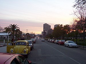

Apoquindo (Runasimi Apuk-kintu flowers for the deity) is the name of a river and pre-Columbian settlement located east of the city of Santiago de Chile, at the foot of the foothills, in the present town of Las Condes. This settlement later became known as the Pueblo de Indios in place names Apoquindo and transferred to an estate, the Mount Apoquindo, the Apoquindo Waterfall, the Apoquindo Avenue, to the district San Carlos de Apoquindo, the Apoquindo College and other geographical landmarks and urban community.
The limits of Apoquindo are: on the north by Mapocho River in the east of Sierra de Ramon with Provincia Mount and La Cruz Mount, south of Quebrada de Ramon and the western Los Domínicos Square. At present, these limits are not as formal as the Avenida Apoquindo extends much further west (Canal San Carlos) to the border with the municipality of Providencia.
Etymology
Its name comes from the Quechua language,[1][2] meaning in Quechua apuk-kintu Flowers for deity ”.[3] While its name is directly related to the worship that was made in the Inca civilization Apu of Mapocho Valley.
When the Incas conquered an area elected as Apu or the highest hill and this Apu a place of worship and sacrifice. Inca culture rendered the care and tutelage Apu the inhabitants of the valleys that were watered by their summits. This Apu was Cerro El Plomo and was harvested Apoquindo the best flowers for worship, as well from which caravans departed Apoquindo were bound to Cerro El Plomo for the qhapaq hucha.
References
Bibliography
- Léon Echaiz, René, "Ñuñohue" Editorial Francisco de Aguirre, Santiago, 1972.
- Ossandón, Dominga and Carlos Ossandón, Guide to Santiago, 9th edition, Editorial Universitaria, Santiago, 1995
- Jaksic FM., Spatiotemporal variation patterns of plants and animals in San Carlos de Apoquindo, central Chile. Center for Advanced Research in Ecology & Biodiversity. School of Biological Sciences, Pontificia Universidad Católica de Chile. .
External links
- Mammals of the central Andes
33°26′29.29″S 70°27′36.77″W / 33.4414694°S 70.4602139°W / -33.4414694; -70.4602139


