Alexander 134A
Indian reserve in Alexander
Alexander 134A | |
|---|---|
Indian reserve | |
| Alexander Indian Reserve No. 134A | |
 Boundaries of Alexander 134A | |
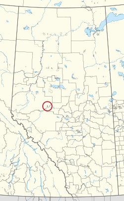 Location in Alberta | |
| First Nation | Alexander |
| Treaty | 8 |
| Country | Canada |
| Province | Alberta |
| Municipal district | Greenview |
| Area | |
| • Total | 2,303.5 ha (5,692.1 acres) |
Alexander 134A is an Indian reserve of the Alexander First Nation in Alberta. Located within the Municipal District of Greenview No. 16,[2] it is 25 kilometres southeast of Fox Creek.[1]
References
- ^ a b "Reserve/Settlement/Village Detail". Crown–Indigenous Relations and Northern Affairs Canada. Government of Canada. Retrieved August 12, 2019.
- ^ Government of Alberta (2019). Municipal Boundaries (Map). AltaLIS.
- v
- t
- e

Cultural areas: Plains, Subarctic
- Algic / Algonquian
- Blackfoot
- Cree
- Plains
- Woodland
- Saulteaux
- Athapascan / Dene
- Siouan
- Nakoda
band governments
| Athabasca Tribal Council (Fort McMurray) | |
|---|---|
| Blackfoot Confederacy (Standoff) | |
| Confederacy of Treaty 6 First Nations (Enoch) | |
| Kee Tas Kee Now Tribal Council (Atikameg) | |
| Lesser Slave Lake Indian Regional Council (Slave Lake) | |
| North Peace Tribal Council (High Level) | |
| Stoney Nakoda - Tsuut'ina Tribal Council (Tsuut'ina) | |
| Tribal Chiefs Ventures (Beaver Lake Cree) | |
| Western Cree Tribal Council (Valleyview) | |
| Yellowhead Tribal Council (Morinville) | |
| Unaffiliated | |
| Not federally recognized |
|
| Not headquartered in Alberta |
|
| Terminated |
|


54°17′03″N 116°26′55″W / 54.284178°N 116.448535°W / 54.284178; -116.448535 (Alexander 134A)
 | This article about an Indian reserve in Alberta is a stub. You can help Wikipedia by expanding it. |
- v
- t
- e


